
On the third and last day of our trip to Death Valley we spent most of our time exploring the Southern end of the park.
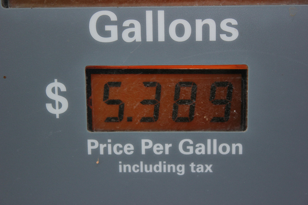
We started off by filling up the gas tank...and it wasn't pretty. Death Valley is in California and the gas prices there are ridiculous anyway...add to that the fact that we were in a very remote location, so of course they could be outrageous with their prices!
We started off the morning by driving on another dirt road to find some VERY remote mines that Ramin had read about online. He knew there was a mine that you could actually walk into and explore. We ended up driving for quite a long time and pulled off the road when we think we found what we were looking for. After hiking up a hill we found the entrance to the cave and this is what it looked like inside!

It was a talc mining operation so everything was white everywhere! The cave itself was cool and creepy, but honestly, we didn't get to go in too far because it looked like it had been purposely closed off (designed to look like a cave in)....but beyond the cave in we could see that the cave didn't go far back anyway. I'd guess we could only walk about 100 feet inside the cave.
This was what the operation looked like on the outside.

There was a rusted up steam roller on the top of the hill and I decided to write our initials on it with some of the chalk...since it was everywhere! Now, if we ever go back there someday, we can see if our initials are still there :P

After out mine exploring we did some more driving and headed to Badwater Basin. This is the lowest point in the Western Hemisphere- it was 282 feet BELOW sea level...how weird is that to think about? All of the whiteness behind us is a salt flat.


Ramin in the middle of the salt flat

The next stop on the list was Natural Bridge. We weren't expecting much out of this since we've been to Arches National Park many times, and those arches can't be beat. But this bridge was cool and it was a nice cool shady hike.
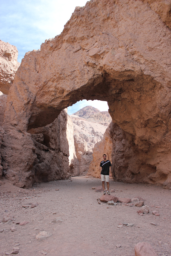
Ramin did some extra climbing while I stayed below.


Here I am further up in the hike with a dry waterfall. You can just imagine the water that rushes down that shoot when there's runoff!


The next stop (keep in mind that all of these places are fairly close in proximity so it didn't take us long to get from one to the next) was Artist's Drive. They call it that because of the spectacular colors of the hills due to all of the minerals in the land (hence all of the stuff to mine). Here I am hiking up a hill that ended up being a bust. All of these people had stopped to hike this hill and we though we'd following in case we missed something cool - we didn't. There wasn't nothing grand at the top :P

This is the main point of attraction on this little loop. It's called Artist's Palette. If you make the picture bigger you can see all of the various colors within the rolling hills. Kinda neat.

Next stop was Harmony Borax Works next Furnace Creek resort area. This was a cool historical exhibit about the mining days. It was also the original site of the old processing plant.

They call this the 20-mule team train. Basically, they'd fill up the large box cars with borax and the barrel car was filled with water to feed the 20 mules it took to haul the whole thing up wherever it had to go. Mules are a big deal in Death Valley.

Our final hike of the day was Golden Canyon. It was supposed to be a good 4-mile hike but after 1.5 miles in I had wasted all of our water by pouring it on me (it was 90 degrees outside at 3pm) and this hike had absolutely NO SHADE at all. I wasn't prepared for this type of hike at all and so we decided to turn around. We did get to see the Beacon though...which is that cool monument in the picture below.

There was a point on our drive out of the park called Zabriske Point and everyone stopped. We did another very short hike up a steep hill to overall Golden Canyon...so in the end I got to see where we just were from above. It was EXTREMELY windy though...everyone was getting dust in their eyes and it was very weird. Here I am in the wind!


Finally, we made our way back to Death Valley Junction and stopped one last time at the Amargosa Opera House because we wanted to see the inside of the actual opera house because we knew the owner, Marta Becket, had painted it back in the 1970s. Here's what we found...along with a cool older gentleman playing the piano when we walked in.


And that was our trip! After this stop we headed to Las Vegas and spent the night in a hotel there. The next day we stopped by Ramin's boss' house in St. George and visited for a few hours and then we headed home. Overall it was a great trip and I'm glad we got away. I love the trips we get to do.
Our next trip will be in June when we'll head to Vancouver and the Pacific Northwest when Ramin's parents will be visiting up there as well!


